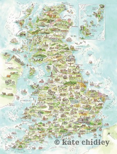
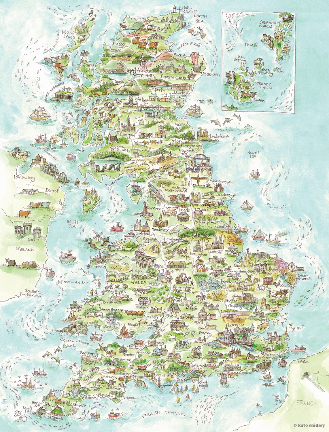
‘England map - farming Isles’
ILLUSTRATED MAP OF ENGLISH FARMING ISLES.
Incy wincy doodled landmarks, animals, fairs and races around the British Isles. From Appleby Gypsy Fair, Tetbury Wool Race, Kippling Cot Derby, Bampton Pony Fair, the Burning Tar barrels of Ottery st Mary, County Shows and more. Fields of lavender, hills of Rhubarb, rows of corn and sweeping grassy hills. Galloways to Shetlands. Dorset Sheep, Gloucester Old Opots to Orpington chickens , Aylesbury Ducks, Wild herds cows of the Isle of Swoona and tailess cats of the Isle of Man. Ooodles of doodles to entain the eyes for hours. There is plenty of did you knows...? in this illustration.
Small prints 33cm x 44cm
Personalised prints...Let me doodle your village or town on the map.
Or a magical place close to your heart.
Personalised samples
https://www.facebook.com/media/set/?vanity=galleryundercanvas&set=a.2478760272209278
Email me. info@katechidley.com
FROM £36.00


Hover over the image to zoom